

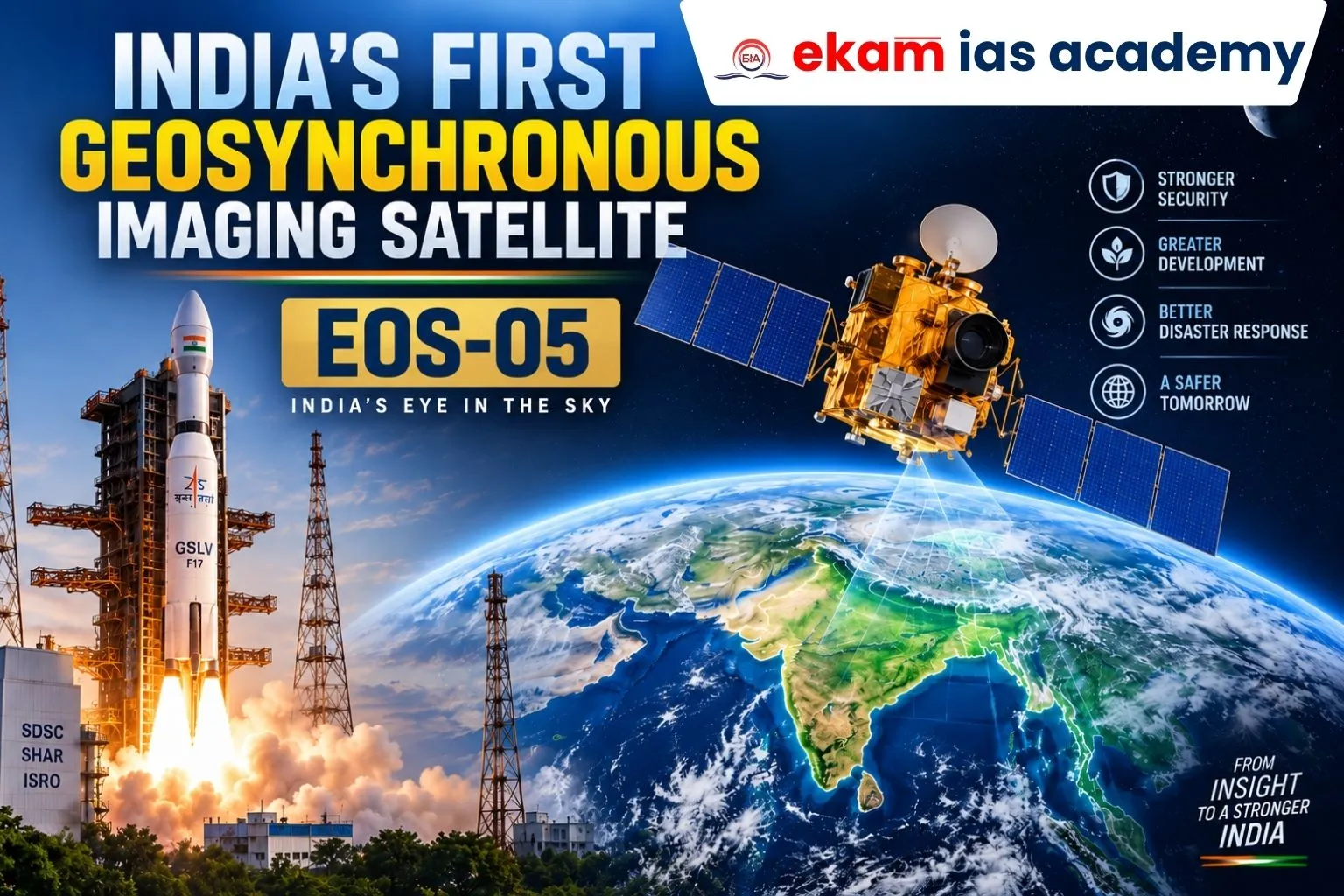
The Indian Space Research Organisation (ISRO) successfully launched its advanced Earth Observation Satellite India, EOS-05, aboard the GSLV-F17 from Sriharikota. This marks India’s First Dedicated Imaging Satellite in geosynchronous orbit at around 36,000 km, providing real-time imagery for strategic and civilian applications. The EOS-05 Satellite represents a major advancement in Satellite Imaging in India, Geospatial Imaging India, and ISRO Satellite Technology.
About EOS-05
- Weight: 2,367 kg, the heaviest payload carried by GSLV so far.
- Orbit: Sub-Geosynchronous Transfer Orbit (Sub-GTO), later raised to geosynchronous orbit.
- Nicknamed “Eye in the Sky” for its real-time monitoring capability.
- Designed to provide continuous Earth imagery from geosynchronous orbit.
- The EOS-05 ISRO mission is regarded as India’s First Geosynchronous Imaging Satellite, strengthening the country’s capability for persistent Earth observation.
- GISAT-1A EOS-05 is designed to enhance real-time monitoring capabilities for both strategic and developmental purposes.
Launch Details
- Vehicle: GSLV-F17, 19th flight of the GSLV series.
- Launch Site: Satish Dhawan Space Centre, Sriharikota.
- Time: 2:55 a.m., injected into orbit in 18 minutes.
- ISRO Chairman V. Narayanan confirmed successful deployment and satellite health.
- The EOS-05 Launch aboard GSLV-F17 EOS-05 marked an important milestone in India’s geosynchronous Earth observation programme.
- The successful EOS-05 Mission also demonstrated improvements in India’s heavy satellite launch capabilities.
Key Features
- Persistent Coverage: Unlike low-earth orbit satellites, EOS-05 can continuously monitor the same region.
- Imaging Payloads: Carries multispectral imagers, including one with 42-metre resolution, the highest ever in geostationary orbit.
- Rapid Revisit: Can image the Indian subcontinent every 30 minutes and priority targets every 5 minutes.
- Dual Use: Supports both civilian applications such as agriculture, environment and disaster management, and strategic surveillance such as border monitoring and defence.
- As a Geosynchronous Imaging Satellite India, EOS-05 strengthens persistent monitoring and rapid revisit capability.
- Its advanced payloads represent an important step forward in ISRO Earth Observation Satellite technology and Geospatial Imaging India.
Applications
- Agriculture: Crop health, irrigation monitoring, land-use changes.
- Disaster Management: Near real-time tracking of cyclones, floods, landslides and forest fires.
- Environment: Continuous observation of cloud systems, pollution and deforestation.
- Strategic Surveillance: Monitoring borders with Pakistan and China, maritime domains and conflict zones.
- The EOS-05 Satellite expands Satellite Imaging in India by providing continuous imagery for policy planning, emergency response and national security.
- The mission also strengthens the operational use of ISRO Satellite Technology for civilian and strategic requirements.
Significance
- First imaging satellite in geosynchronous orbit – ensures real-time, continuous coverage unlike low-earth orbit satellites.
- Applications:
- Agriculture monitoring (crop health, irrigation).
- Disaster management (cyclones, floods, wildfires).
- Environmental studies (deforestation, pollution).
- Strategic surveillance (border monitoring, defence).
- Strengthens India’s space-based infrastructure and reduces reliance on foreign imagery.
- India’s First Geosynchronous Imaging Satellite enhances the country’s independent Earth observation and strategic surveillance capabilities.
- The EOS-05 Mission further strengthens India’s position in advanced Earth Observation Satellite India systems.
Relief for ISRO
- Comes after back-to-back failures:
- PSLV-C62/EOS-N1 (Jan 2026).
- PSLV-C61 (May 2025).
- ISRO had paused launches to reassess systems.
- EOS-05 success restores confidence in India’s launch capabilities.
- The successful EOS-05 ISRO mission reinforces confidence in India’s launch vehicle programme and broader ISRO Satellite Technology ecosystem.
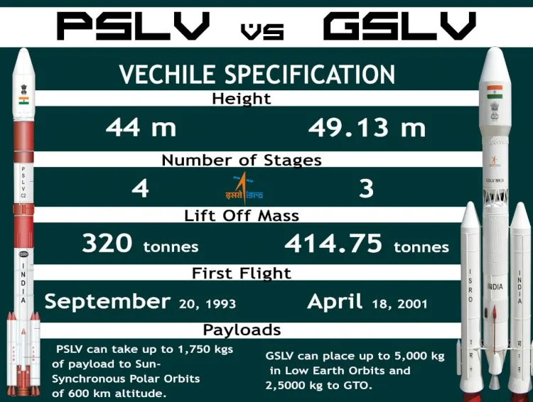
Evolution of GSLV
- First GSLV-D1 carried 1,536 kg payload.
- Continuous improvements in structural mass optimization and propulsion systems.
- GSLV-F17 carried 2,367 kg EOS-05, the heaviest satellite yet.
- The success of GSLV-F17 EOS-05 reflects the steady evolution of GSLV’s payload capacity and India’s capability to deploy advanced satellites into higher orbits.
Conclusion
The launch of EOS-05 is a strategic milestone for India’s space programme. It not only strengthens national security and disaster preparedness but also showcases ISRO’s resilience after recent setbacks. With EOS-05, India enters a new era of real-time geosynchronous imaging, reinforcing its position in the global space community.
As India’s First Dedicated Imaging Satellite, EOS-05 strengthens Satellite Imaging in India, Geospatial Imaging India, and the country’s strategic Earth observation infrastructure. The topic is also highly relevant for EOS-05 UPSC, particularly under GS Paper 3 themes related to space technology, disaster management, agriculture, national security and technological self-reliance.



One thought on “EOS-05 Satellite : India’s First Dedicated Imaging Satellite”